Texada residents oppose new quarry
 On July 23, adelegation from the SCCA and Friends of Davie Bay met on Texada Texada Island. LeHigh Hanson Materials Ltd. wants to open a new, big quarry on Texada. The Friends have filed a court challenge. They want a … Read More “Texada residents oppose new quarry”
Texada residents oppose new quarry Read More
 Glass sponge reefs were thought to have gone extinct 30 million years ago, but in 1987 researchers mapping the sea floor discovered them in Georgia Strait. There’s a reef in the waters off Sechelt and another near Roberts Creek.
 Sunshine Coasters have known in their hearts for generations that the Gospel Rock area is special. Currently available scientific information, provided through the Provinces Conservation Framework, strongly supports this widely held point of view.
 Environmental advocates from all over the greater Sunshine Coast region gathered at Camp Byng in Roberts Creek on the Spring Equinox, March 20 and 21 for two days of fun, fellowship, networking and workshops.
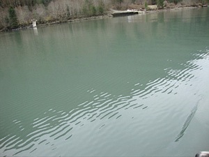
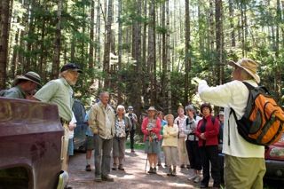
 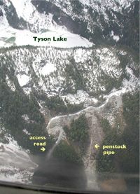 Tyson Lake, April 30, 2010. As the lake level was drawn down, ice came to rest on the sediment delta at the left side of the picture causing silt to be distributed throughout the lake. The only visible patch of …