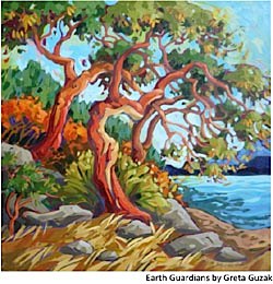
 Sunshine Coasters have known in their hearts for generations that the Gospel Rock area is special. Currently available scientific information, provided through the Provinces Conservation Framework, strongly supports this widely held point of view.
To continue reading this article, click Read more, below.
Read the Questions to the Conservation Data Center about Gospel Rock
Carmen Cadrin answers for the CDC
The land in the Gospel Rock Neighbourhood Plan area is within the Coastal Western Hemlock very-dry maritime biogeoclimatic subzone (the CWHxm BEC Unit). The CWHxm is one of the most heavily disturbed ecosystems in the lower mainland and along the coast, second only to the Coastal Douglas Fir moist maritime (CDFmm).
Approximately 8% of the CWHxm occurring on Crown land in the Sunshine Coast Regional District has been protected. Less than half of this land is in old growth condition because the inventory of old growth is much smaller than the 8% target. This is entirely due to the history of human settlement and industrial, agricultural and forestry-related uses.
 The particular site type of the standing forests above and below Gower Point Road (CWHxm 02/03) is naturally rare. The Provinces Conservation Data Center recognizes these stands as Imperiled and Imperiled to Vulnerable. As well, the Ministry of Environments Conservation Framework recommends Private Land Stewardship and Ecosystem Protection for these risk classifications.
Obviously, conservation values of the standing forests along the waterfront and up to the ridge are, by any scientific measure, very high. There are ecologically degrading influences present (alien species and impacts from Gower Point Road). However much this is a challenge, there are well-established ways and means to achieve restoration. These problems do not diminish the conservation value of the land.
Municipalities all over the province are taking steps to protect sensitive, high conservation value lands and waters. The Green Bylaws Toolkit details their efforts and gives guidance. The Conservation Data Center offers assistance to municipalities and the public in understanding what is ecologically important. Municipalities have every right to establish protection of ecologically significant land whenever subdivision or land use approvals are pursued. Such an action does not require compensation to land owners or developers.
Introduction
Environmental values have been highly controversial during the Gospel Rock Neighbourhood Plan (GRNP) process. Most of the planning area has a history of disturbance, some of which occurred during the planning process. The waterfront and slope above Gower Point Road still has naturally maturing forests. These forests, especially below the road, have been degraded somewhat by alien species like Scotch Broom and Periwinkle. The road itself also has a degrading influence. Generations of Sunshine Coasters have appreciated these forests and felt that they are special. The SCCA believes that scientific inventory and evaluation entirely supports this feeling that the Gospel Rock forest is special, regardless of the current presence of a road and alien species. In the following paragraphs we will outline some of the readily available technical information that supports this point of view.
Scientific Inventory
In British Columbia we use a systematic method for identifying ecosystems and understanding their distribution. The system has a big name; Biogeoclimatic Ecological Classification system, or simply the BEC system. Professionals working in the fields of forestry, fish and wildlife management or any aspect of land use planning use the BEC system. It gives us a way to determine what is common, what is rare, what conservation priorities should be and an understanding of what management issues are likely to arise over time.
Biogeoclimatic Zones
BEC Zones are typically named after the dominant tree species of a fully matured old growth forest. For example, The Coastal Douglas Fir (CDF) biogeoclimatic zone has Douglas Fir as the leading species in old growth stands and also regenerates Douglas Fir naturally whenever stands are disturbed. CDF forests occur on the Gulf Islands and on the East side of Vancouver Island and also in a small area locally around Halfmoon Bay. Most of the waterfront along the Sunshine Coast, up to ~2000 feet of elevation, is in the Coastal Western Hemlock (CWH) BEC Zone. These CWH forests dominate the coast of British Columbia. In our area, you can see Western Hemlock and Red Cedar developing under the canopy of Douglas Fir. Eventually these Hemlock and Cedar trees will be the dominant trees of old growth stands.
BEC Sub-zones
 Most ecosystem inventory information, at the landscape level, relates to biogeoclimatic sub-zones also called BEC units. In the nomenclature of the BEC system, sub-zones are identified by descriptors. The CDF for example has only one sub-zone, the moist maritime (CDFmm). Moist maritime basically means ocean-influenced wet climatic. The CWH Zone has 15 sub-zones. The lowest elevation CWH sub-zone along the Georgia Strait is the very-dry maritime (CWHxm). This sub-zone also occurs in the Fraser Valley out to Chilliwack and on Vancouver Island. This is the driest sub-zone of CWH in BC. A few small examples of mature CWHxm forest can be found at Soames Hill Regional Park, Smugglers Cove and Francis Point provincial parks. Information is available telling us about the distribution of each BEC unit in the province and the distribution of each BEC unit in each of the landscape units of each region. Information about stand ages within each BEC unit is also available. When we consider conservation values, we want to know how much of a given ecosystem is there, where it is, and what condition it is in.
Plant Associations and Site Series
There is a range of site types within each BEC unit. These site types range from very dry to very wet and also from nutrient poor to nutrient rich. Each site has a characteristic water and nutrient regime and association of plants. The number 01 identifies the most typical site type in a BEC unit, the site that has the most average water and nutrient availability. By definition, the 01 site type occupies about 50% of the land base within the sub-zone. The driest site is identified as 02 and the wettest site will be 12. A practicing professional will see, in his or her minds eye, a picture of an ecosystem when a classification is mentioned. For example, in the case of CWHxm12, the image is of small ephemeral ponds, ringed by skunk cabbage with Salal growing on dry hummocks and stump tops. Cedar will be the leading tree species and there will be a component of Sitka Spruce; a special ecosystem deserving of respect and protection!
Plant Communities At-Risk
There is great deal of misunderstanding about what plant communities at-risk are. An endangered plant community can only be definitively identified in the field in its old-growth occurrence. The status of particular plant communities is assessed federally by the Committee on the Status of Endangered Wildlife in Canada (COSEWIC) and provincially by the Conservation Data Center (CDC). The CDC also uses the Conservation Framework to identify priorities. Using the protocols of the CDC, a BEC sub-zone and site is identified as the host ecosystem of potential plant communities at-risk. For example, the Coastal Western Hemlock extra-dry maritime 02 (CWHxm 02) is the host ecosystem of a Red-Listed plant community. The relationship between the ecosystem and the at-risk plant community is very much like the relationship between an at-risk species and its habitat. Current scientific thought is that species needs are addressed though habitat conservation and likewise, the needs of at-risk plant communities are addressed through ecosystem conservation.
Ecosystems in the Gospel Rock Neighbourhood Plan area
The forested slopes above and below Gower Point Road are within the Coastal Western Hemlock extra-dry maritime BEC unit. In general, the CWHxm is of extreme conservation concern because so much of it has been extensively altered for housing, agriculture, transportation, heavy industry and forestry. Very little of this BEC unit has been protected. In the Fraser Valley, for example, there is virtually no old growth of this classification left and very little actual forested land at all. Here on the Sunshine Coast, approximately 8% of the CWHxm crown land base has been protected as Old Growth Management Area (OGMA). The majority of these OGMA parcels are not actually old growth; they are second growth forests because the inventory of old growth is far below the target of 8%. Many of these OGMAs have the same problems with roads and alien species that the Gospel Rock forest has. Yes, just the existence of a maturing stand of CWHxm at Gospel Rock indicates a high value for conservation.
The site series of the Gospel Rock forest is also highly significant. The 02/03 site type is unusual. It naturally occupies only a very small portion of the range of the CWHxm and is the driest plant community of any of the plant communities within the 15 sub-zones of the CWH. Extreme rarity indicates a very high value for conservation whether the cause is natural or induced by human activity. The Gospel Rock stand is not yet old growth, is disturbed and does have an infestation of alien species. Given the state of the environment, i.e., the condition of lands that are or could be protected, the Gospel Rock forest still has extremely high value for conservation
Information from Landscape Unit Plans as well as the Sensitive Ecosystem Inventory tells us what the range of the CWHxm sub-zone is, where its distribution is on the coast, and especially on the Sunshine Coast, the extent of disturbance that has occurred and the amounts of land in the various age classes. We also have detailed information about risks to these stands in terms of pests, disease, hazards, competing uses etc., etc. Taken together, all of these sources indicate that conservation of CWHxm stands is an urgent priority. The Conservation Framework supports this view as well.
The Conservation Data Centers Sensitive Ecosystem Inventory shows two ecosystems in the Gospel Rock Neighbourhood Plan Area; one Imperiled and one Imperiled to Vulnerable. These are the stands above and below Gower Point Road. The CDC also states that, under the Conservation Framework, these ecosystems are identified as Priority 2 (out of 6 priority classes) meaning that Private Land Stewardship and Ecosystem Protection are recommended.
Conservation Tools
 A rich body of knowledge about how municipalities and regional districts are responding to urgent conservation priorities is accumulating in British Columbia. Judging from the quality of the draft hybrid option plan, it appears that the Town of Gibsons could learn a great deal about how other jurisdictions are protecting environmental values. A wonderful source of information about conserving ecosystems and green infrastructure is the Green Bylaws Toolkit published by Environment Canada, British Columbia, the Real Estate Foundation and various other partners.
The value of land increases dramatically when municipalities allow land to be sub-divided, especially in a situation where high-density housing opportunities are created. It is accepted that municipalities have a right to a portion of the value added to land through subdivision, for purposes related to the public good. Also, when land is developed, a burden comes to bear on municipalities in the form of infrastructure service obligations. This is why municipalities require amenities to be provided and/or land to be given to the public when subdivisions are approved. According to the Green Bylaws Toolkit
local governments can approve conservation zoning for legitimate community purposes, such as ecosystem protection, as long as the zoning does not restrict a property to a public use (e.g., a park).
Also stated in the Green Bylaws Toolkit and referenced to Section(s) 5.4 and 914 of the Local Government Act;
Local governments do not have to pay any compensation to land owners for changes in the value of land due to rezoning enacted in the public interest.
In other words, the Town of Gibsons has every right, a variety of potential tools and a rare opportunity to protect thoroughly documented ecologically sensitive, high conservation value land in the Gospel Rock Neighbourhood Plan area.
Let’s hope the Mayor and Council will be successful in protecting the public interest in the Gospel Rock Neighborhood Plan area.
Daniel Bouman, Executive Director
Sunshine Coast Conservation Association
ALSO: Read the Questions to the Conservation Data Center about Gospel Rock
Carmen Cadrin answers for the CDC
Photos credits:
View below the road: Katie Janyk
Arbutus, and Sunrise Fog: Alan Sirulnikoff